Spatial Data Analysis with R
Society for Conservation GIS, July 2021
Introduction 
Introduction

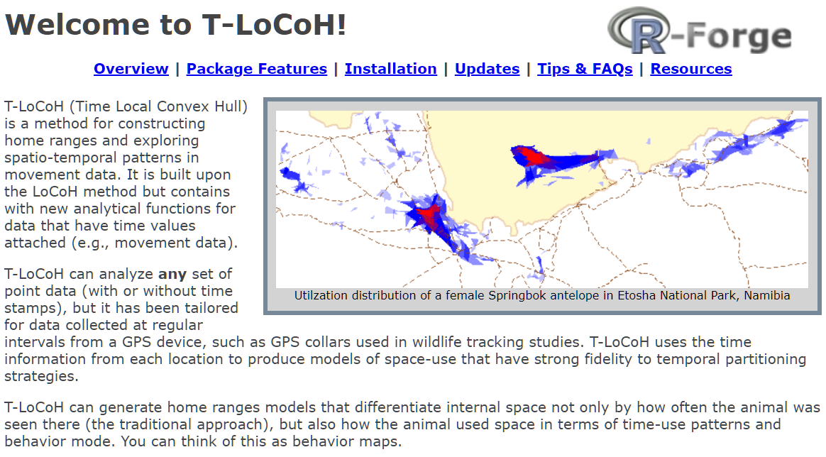
Home range constructor and spatial-temporal pattern analysis for wildlife tracking data
http://tlocoh.r-forge.r-project.org/
Data management utilities for drone mapping.
https://ucanr-igis.github.io/uasimg/

Catalogs and manages drone images (sample)
Estimates footprints, computes overlap, explorts flight area to Shapefile
Creates World Files for single images

Bring climate data from Cal-Adapt into R using the API
https://ucanr-igis.github.io/caladaptr/
Chill Portions Under Climate Change Calculator
https://igis.shinyapps.io/chill/
Drone Mission Planner for Reforestation Monitoring Protocol
https://ucanr-igis.shinyapps.io/uav_stocking_survey/
Stock Pond Volume Calculator
https://ucanr-igis.shinyapps.io/PondCalc/
Calculator for Estimating Costs and Benefits of Medusahead Control
https://ucanr.shinyapps.io/medusahead_ipm/
Get better at:

Wind up a little higher on the learning curve!

foundational concepts
+ code recipes
+ working examples
+ practice
+ a good search engine
functional pRoficiency!
Slides
Keyboard shortcuts for slides:
A: toggle display of current vs all slides
S: make fonts smaller
B: make fonts larger
F: toggle display of the footer
C: Show table of contents
Practice
Community Forum
Virtual Environment
Data
RStudio Cloud: see ‘data’ directory in project
RStudio Desktop:
create a workshop folder
download data folder
usethis::use_course("bit.ly/rspatial-data", destdir = ".")or download zip from https://bit.ly/rspatial-data and extract
Other Resources & Cheatsheets
Getting Help


![]()
![]()
RStudio Cloud project for this workshop: https://rstudio.cloud/project/2709500

R Notebooks are written in “R Markdown”, which combines text and R code.
We’ll be using R Notebooks for many of the workshop exercises.
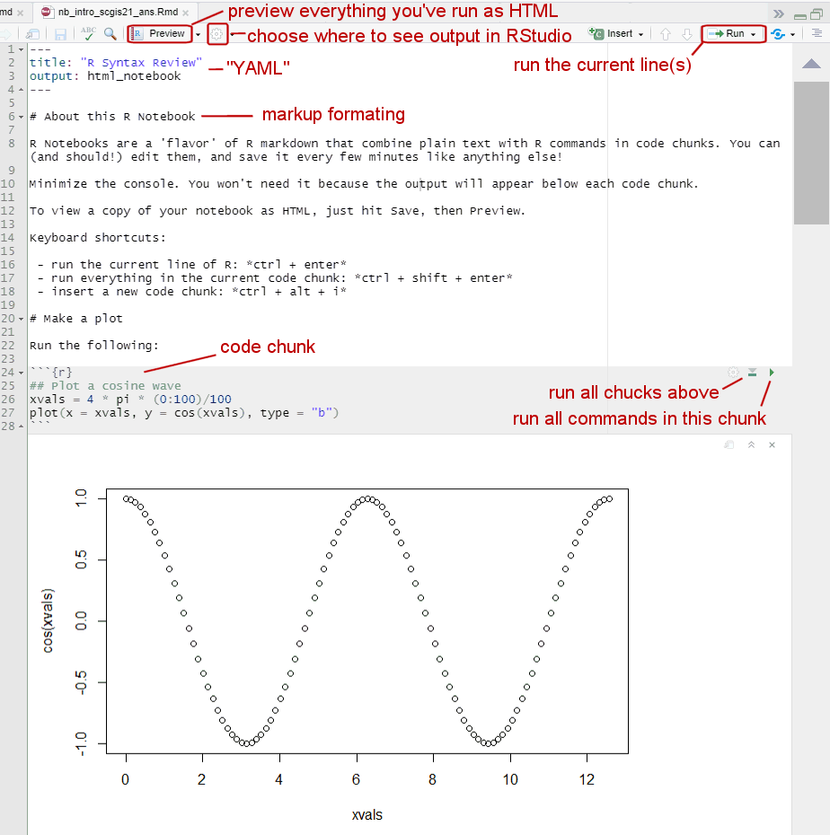
When you’re in a R Notebook, the working directory is where the notebook Rmd file resides.
## Warning in if (is.na(nb_desc_chr)) {: the condition has length > 1 and only the first element will be usednb_intro_scgis21.Rmd
Introduction to R Notebooks