Hopland REC Watershed 2 Flights, 2017
These images were collected in 2017 to map Watershed-2 for longitudinal monitoring and possible restoration planning. Watershed-2 has steep topography. In the 1960s, much of it was cleared of shrubs and oaks as part of an experiment to increase forage for sheep.
Flight Areas
Download: Flight area(s) (KML)
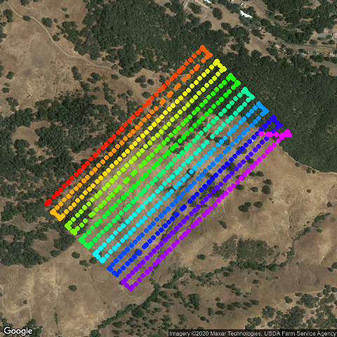
HREC Watershed 2, Flight 1 (RGB)
One of four RGB flights to create a vegetation snapshot and topographic model of Watershed 2 for restoration planning and longitudinal monitoring.
Date captured: 2017-08-18
Pilot: Shane Feirer, IGIS
Camera: DJI ZenMuse X3
Num images: 637
Area: 129.4 acres
Data size: 3,177 MB
Contact: Shane Feirer, IGIS
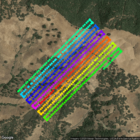
HREC Watershed 2, Flight 2 (RGB)
One of four RGB flights to create a vegetation snapshot and topographic model of Watershed 2 for restoration planning and longitudinal monitoring.
Date captured: 2017-08-18
Pilot: Shane Feirer, IGIS
Camera: DJI ZenMuse X3
Num images: 593
Area: 123.5 acres
Data size: 2,961 MB
Contact: Shane Feirer, IGIS
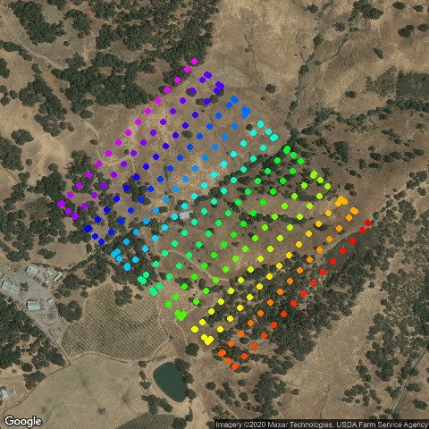
HREC Watershed 2, Flight 3 (RGB)
One of four RGB flights to create a vegetation snapshot and topographic model of Watershed 2 for restoration planning and longitudinal monitoring.
Date captured: 2017-08-18
Pilot: Shane Feirer, IGIS
Camera: DJI ZenMuse X3
Num images: 244
Area: 131.7 acres
Data size: 1,219 MB
Contact: Shane Feirer, IGIS
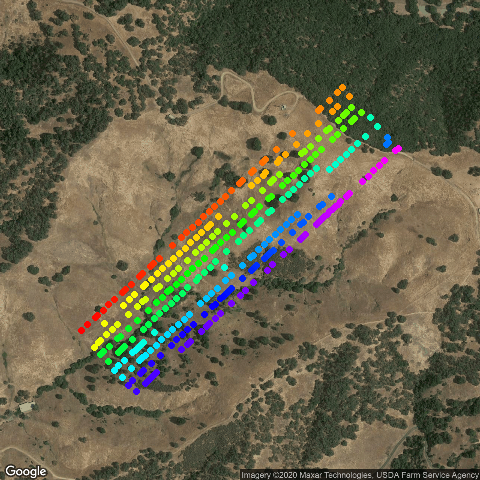
HREC Watershed 2, Flight 4 (RGB)
One of four RGB flights to create a vegetation snapshot and topographic model of Watershed 2 for restoration planning and longitudinal monitoring.
Date captured: 2017-08-23
Pilot: Shane Feirer, IGIS
Camera: DJI ZenMuse X3
Num images: 362
Area: 83.4 acres
Data size: 1,791 MB
Contact: Shane Feirer, IGIS